Nevis Field Results 2003 - 1997
Survey and Discovery; Jamestown; Mill structures, architecture, and industrial artifacts; Results
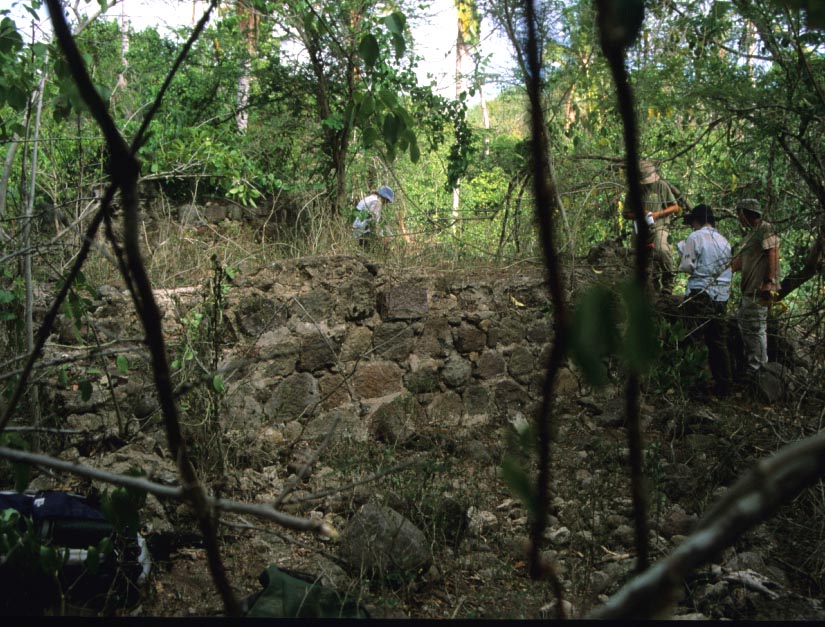
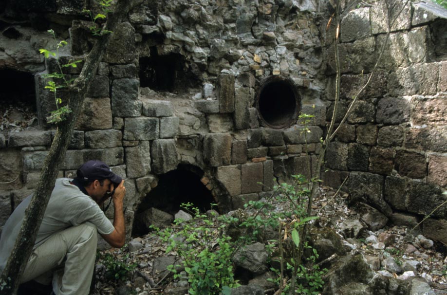
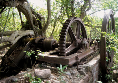
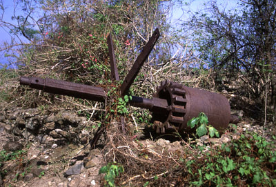
During the 2002 and 2003 seasons, multiple previously unknown sites of sugar mill-complexes, colonial residences, curious masonry foundations, and potential pre-emancipation era villages were identified. Each site was recorded by GPS and in many cases, measured drawings were produced from field recordings. Exploratory archaeology is hard work, often requiring long hours of hiking in hot and humid conditions. But the rewards were many. Results from the 2002 and 2003 seasons alone provided enough data to sustain multiple research objectives and yielded important new information related to settlement patterns during the early centuries of the colony. In the image above, the field crew is preparing to make measured drawings of the masonry remains of a former boiling house and mill dated to the mid to late eighteenth century. The site is not identified on any historic maps, however, we believe it also has structures suggesting its functioning as a distillery, so we are hopeful of finding records that will identify the site.
Legend holds that Jamestown, the first settlement on Nevis, was destroyed by an earthquake or tidal wave in 1690 (or earlier depending on which version you prefer). Although the location of Jamestown has been known largely through oral traditions, a few historic maps offer clues. Invited by the NCHS to examine the site in 200, We returned in 2002 to investigate the supposed location and roughly surveyed the swampy coconut grove that now covers the site. Several structures were found beneath the brush and mapped. A single test unit was excavated along the foundation wall of a possible warehouse. Artifacts on the surface included bottle glass, clay pipe bowls and stems, ceramic shards and a brass, snake shaped, scabbard retainer clip for a sword of late seventeenth century vintage. A team from University of Southampton has conducted extensive geophysical work in the area and has plans to conduct further study of the Jamestown site. In terms of landscape evolution, Jamestown is important as the first evidence of land use and settlement patterning between 1627-1690. Although tradition holds that it never recovered from the natural disaster, Jamestown is nonetheless mentioned in documents after 1706, suggesting at least that it continued to be occupied, even if losing its dominant role. Charlestown soon became the principal shipping and commercial center. Jamestown
To initiate our other objectives, and as a form of relief from the rigors of transects, we archaeologically tested at Jamestown. We surveyed through the coconut palm thickets situated between the main road and the beach. Actually, we extended our survey beyond the beach, exploring with a team of divers offshore. In search of evidence of Jamestown debris, divers conducted underwater transects perpendicular to the beach, ten feet apart, out two hundred yards. If Jamestown disappeared during a tidal wave as some stories have it, evidence might be expected on the seabed, as was the case in Port Royal, Jamaica, which itself was destroyed by an earthquake in 1692. The survey visually examined the area between a new beach access rod that has been bulldozed through the palms and the area directly fronting Ft. Ashby. This area has already been subject to a geophysical survey by a team from Southampton University. Nothing but sand was detected, and depth never exceeded ten feet. Only an occasional conch shell punctuated the monotony of sand. Lacking a sub-bottom profiler or magnetometer on this trip, we had to satisfy ourselves with this preliminary visual inspection.
To initiate our other objectives, and as a form of relief from the rigors of transects, we archaeologically tested at Jamestown. We surveyed through the coconut palm thickets situated between the main road and the beach. Actually, we extended our survey beyond the beach, exploring with a team of divers offshore. In search of evidence of Jamestown debris, divers conducted underwater transects perpendicular to the beach, ten feet apart, out two hundred yards. If Jamestown disappeared during a tidal wave as some stories have it, evidence might be expected on the seabed, as was the case in Port Royal, Jamaica, which itself was destroyed by an earthquake in 1692. The survey visually examined the area between a new beach access rod that has been bulldozed through the palms and the area directly fronting Ft. Ashby. This area has already been subject to a geophysical survey by a team from Southampton University. Nothing but sand was detected, and depth never exceeded ten feet. Only an occasional conch shell punctuated the monotony of sand. Lacking a sub-bottom profiler or magnetometer on this trip, we had to satisfy ourselves with this preliminary visual inspection.
To understand the relationship between landscape, settlement, and worldviews it is necessary to reconstruct past environments and analyze subsequent changes in the context of changing socioeconomic models. It is also necessary to locate various archaeological sites of different historic periods for comparing spatial organization and spheres of social interaction. As capitalism emerged among the colonies in the Caribbean, there arose a new social system, that gradually supplanted the former system based on a feudal mode of relations. Several social scientists and archaeologists have argued that every social system has a unique signature of spatial organization and socio-spatial dynamics. In turn, it can be suggested that landscape change—the use and organization of space and environment--can be interpreted through the lens of socioeconomic transformation. Discovering how landscapes change can help us better understand the context of human behavior and affects capitalism’s penetration into various sectors of colonial societies.
The landscape approach in archaeology is not especially new, but its incorporation into economic or social theory is a relatively recent development. The landscape approach is a particular methodology, borrowing techniques and theories from historical geography, economic history, ecology, and anthropology. It follows a non-traditional conceptualization of sites—one that focuses on interconnectedness, and networks of relations rather than isolated phenomena. A plantation viewed in this framework is not simply as an autonomous agricultural entity, but as a community, imbedded in a wider system that exerts influence on behavior at several scales. For example, enslaved Africans were not simply labor to an estate, but had lives and communities of their own, interacting with slaves and planters elsewhere on the island. Similarly, planters, merchants, and shipping companies were involved in intricate relationships of trade, credit, and status. Citizens in Bristol or Liverpool were as caught up in the web as those living on the island. Wealth and population increase in these two cities grew in proportion to success in the West Indies. Decisions made regarding planting, land sales, estate consolidation, and the like had consequences reaching into people’s live, how and where they lived, and the resources they could access.
We are focused directly on the use of space and patterns of living across the physical landscape over time, and in determining how these patterns shaped, or were shaped by, the way people lived and interacted. To offer one further example, a road can be understood as a transportation link for movement of goods, but also as a conduit of social interaction; as a landmark having different meanings to people at different social strata; as a property boundary; as a system for structuring daily routines; or as a physical reminder of status or control. And a road may have different uses or values in different eras. Abandonment of estates either through economic or ecological failure can lead to road deterioration and neglect. The result is a region significantly underdeveloped compared to other areas in a landscape choked by invasive vegetation. Each of these issues is deserving of scholarly attention.
Landscape use can also be understood from a social perspective. In a recent study of the Jamaican coffee plantation system, James Delle marshaled compelling arguments for the use of landscapes in social control. The placement of estate Great Houses and churches on hills in close association, served to both, physically associate authority on high ground and to link the two sources of authority in the minds of the populous. One “looked up” to authority physically as well as metaphorically, thereby reinforcing and justifying existing status and social hierarchies.
Delle’s research focused on the post-emancipation era. The period of interest for our study is first settlement in 1627, through emancipation in 1833. While estates and plantations are certainly included in the overall analysis, they are treated as nodes of the broader network that also encompasses villages, towns, commercial centers, harbors, military works, and other modifications to the built environment—island infrastructure. The significance of these features and their spatial organization is likely to have fluctuated as economic, political and institutional forces varied. If to this complexity we add the influence of environment and the impact of environmental change, it becomes obvious that societies must adapt or cope with developments at several scales and levels. Some environmental change is natural, but much is wrought by a combination of human enterprise and folly. Expedient agricultural practices that hasten erosion may yield quick profits but damage future agricultural potential. Deforestation leads to water loss and soil degradation. These processes were generally understood by Europeans in the17th and 18th centuries and some efforts were made to ameliorate them.
The question then becomes; how do we analyze this complexity? Consider a plantation. It can be studied from the micro level to determine how households were organized or how persons of differing social classes interacted and molded society—where they built and what local factors governed their choices. Or it might be examined from a mezzo scale to learn how plantations interacted with one another and in other settlement spheres (towns, religious institutions, etc.), or how enslaved Africans created a new society within this context. At a still greater scale, analysis proceeds from a macro-level perspective to illuminate how commercial or political decisions made in European States impacted life in each sector of colonial society. At this scale it is possible to evaluate, for instance, how an event such as the American Revolution, or sugar production in India, impacted Nevisan planter and slave alike, although in significantly different ways. Although it is often suggested that colonists tried to recreate the mother country, this simply is not what occurred. New institutions and new social systems emerged from the unique experience of Caribbean colonial life, and this was as true for Europeans as for Africans in bondage. Because so much of its archaeological landscape is intact and continues to shape the lives of modern inhabitants, Nevis is especially well suited for investigating these intricate and tangled processes
The teams come to Nevis with several goals, foremost to explore the landscape approach on Nevis, as a feasible method for examining social change and for learning at what scales change can be observed archaeologically. This initially involved devising a suitable sampling strategy for locating historic sites of various types and scales (houses, villages, agro-industrial sites, military installations, and so forth). In the process, we planned to physically walk the landscape guided by the 1984 Ordnance Survey map, and to identify by type the various structures described merely as “ruin” on the map. In addition, we wanted to investigate “blank” areas for evidence of archaeological sites. Determining whether spatial use during the earliest phases of settlement on Nevis could be archaeologically determined or substantially differed from latter settlement patterns was our second goal. For this assessment we elected to study the possible site of Jamestown. A third important aspect of this project was assessing environmental change, both natural and artificial.
The Parishes of St Thomas Lowland and St John Figtree are being used for this study as a sample set, and within these Parishes, a more discreet sample is eventually to be obtained. These two Parishes were areas of first and most intensive settlement and development during the first two centuries of colonial rule. These two areas, therefore, are likely to exhibit patterns, and settlement signatures, of the type that we are interested in analyzing. Our primary focus of this season was the remote areas of St John Figtree bordered by Saddle Hill and the sea.
The Parishes of St Thomas Lowland and St John Figtree are being used for this study as a sample set, and within these Parishes, a more discreet sample is eventually to be obtained. These two Parishes were areas of first and most intensive settlement and development during the first two centuries of colonial rule. These two areas, therefore, are likely to exhibit patterns, and settlement signatures, of the type that we are interested in analyzing. Our primary focus of this season was the remote areas of St John Figtree bordered by Saddle Hill and the sea.
St John
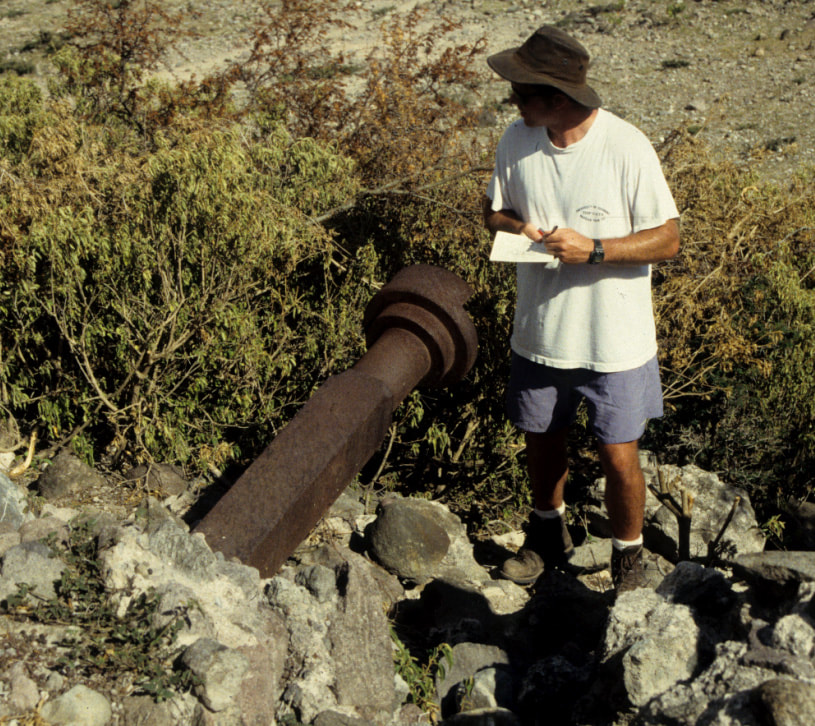
Fieldwork was intensive and difficult because the areas examined within St John Parish were often steep and densely overgrown. Each plant, especially the Acacia species, seemingly competed with the others for the longest, sharpest spines, needles, or thorns. Working daily from our guest house located on Cole Hill, the team walked out from Cox Village along compass transects NW toward the sea, between Saddle Hill and Brown Hill. Old roads were followed, as well as any footpaths shown on the 1984 Ordnance Survey map. Goats and donkeys were our constant companions, and were likely responsible for many of the paths we followed. Former habitation sites were documented and examined along with several other ruins and mill sites. Each was plotted by GPS. A single swath running between Brown Pasture and The Hermitage at its highest and northern-most points, down to the cliff edges between Whitehall Estate and the area below Dogwood Estate, bordered by Grandee Ghut, provided this season’s sample. Transects were often carried out along ridges and down into ghuts. Team members were spread out over the landscape at 100 to 500 foot intervals, or on occasion in pairs. At other times in much closer proximity. Several large stone foundations, now completely overgrown, and obscured from view from even only a few feet away, were discovered on the ridges
Fieldwork was intensive and difficult because the areas examined within St John Parish were often steep and densely overgrown. Each plant, especially the Acacia species, seemingly competed with the others for the longest, sharpest spines, needles, or thorns. Working daily from our guest house located on Cole Hill, the team walked out from Cox Village along compass transects NW toward the sea, between Saddle Hill and Brown Hill. Old roads were followed, as well as any footpaths shown on the 1984 Ordnance Survey map. Goats and donkeys were our constant companions, and were likely responsible for many of the paths we followed. Former habitation sites were documented and examined along with several other ruins and mill sites. Each was plotted by GPS. A single swath running between Brown Pasture and The Hermitage at its highest and northern-most points, down to the cliff edges between Whitehall Estate and the area below Dogwood Estate, bordered by Grandee Ghut, provided this season’s sample. Transects were often carried out along ridges and down into ghuts. Team members were spread out over the landscape at 100 to 500 foot intervals, or on occasion in pairs. At other times in much closer proximity. Several large stone foundations, now completely overgrown, and obscured from view from even only a few feet away, were discovered on the ridges
The survey sample in St John demonstrates the utility of the sampling methodology put into practice for this project. In all, some 22 site types were recorded, including house platforms, possible village sites, sugarworks and mill platforms, historic roads, terracing, and cisterns. Many of the sites were indicated by scatters of domestic ceramics and other household goods, such as, bottles, flatirons, iron kettles, along with the presence of ecological indicators. Guinep (Melicoccus bijugatus) and Tamarind (Tamarindus indica) trees were often in association with these sites. Although the majority can be roughly dated on the basis of surface finds to the nineteenth century and some from the early twentieth, a few are earlier, and one or two may have their origins in the seventeenth century. These deserve more attention. We did not have time or resources this season to test below the surface so many promising sites. Rich data on environmental modification, intentional and otherwise, was also recorded, including evidence for terracing, remnant gardens, invasive vegetation, and animal trails.
Of particular interest was the discovery of at least two mills and sugarworks not indicated on the 1984 Ordnance map, although possibly illustrated on the Burke Iles map of 1871. One of these we have tentatively identified as Prenlis Estate sugarworks (although it could be another unknown works), the other lies down slope between Bush Hill and Coxheath. Neither has a windmill tower but each has a mill platform suitable for an animal mill immediately adjacent to the boiling house. Perhaps the lack of a tower is the reason they have escaped attention. The Prenlis works (if that is indeed what it is) stands two stories and is quite compact in organization. We were not the first to locate these structures as the presence of modern liquor bottles testifies. And both were so thickly overgrown we must attribute our finding them nearly as much to serendipity as to anything else, yet finding them vindicates the sampling methodology. A third mill site, near Montpelier, may be associated with Beaumont Estate, with significant similarities to the Prenlis layout—lacking tower, but with a platform and compact adjacent boiling house.
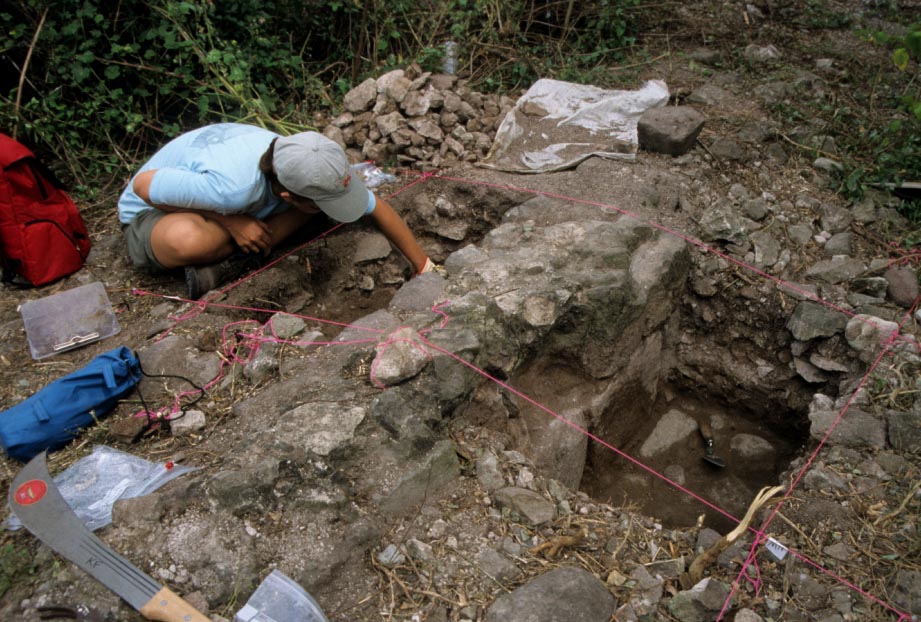
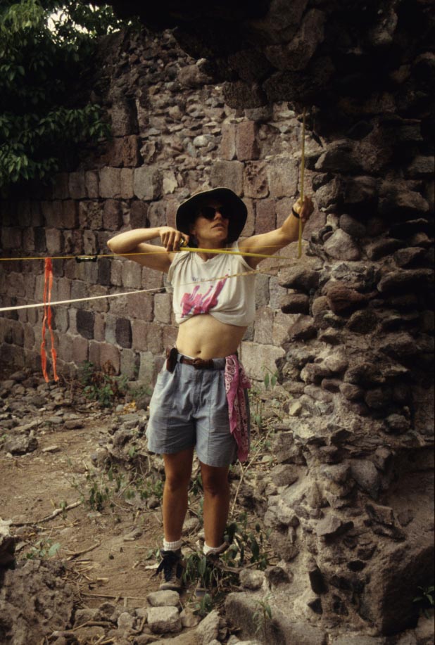
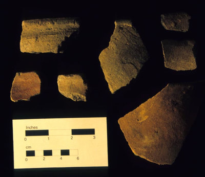
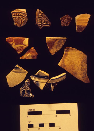
At Jamestown an area fronting the main road opposite the Equestrian Center, measuring 200 by 100 feet, was exhaustively surveyed. Foundations of several structures, roughly sketched during my trip to Nevis in 2000, were cleared of overgrowth, and carefully mapped. Some of these structures were impacted by the recent widening of the main road, and were investigated last year by a team from University of Southampton. Our team concentrated on one set of exposed foundations with the intent of obtaining construction details and chronological information. Two buildings sharing a wall, or at least abutting one another, and angled slightly, were of markedly different construction and states of preservation. Additionally, parallel foundations in close proximity, are suggestive of warehouses and alleyways, possibly paralleling a former waterfront. A similar arrangement can be found on St Eustatius. The two buildings combined measured 15.93m (51 feet, nine inches) in length. The northern most wall measured 6.86 m (22 feet 4 inches) but only 3.81m (12 feet 6 inches) of wall is extant at the surface on the southern end and we elected not to attempt exposing it. We tested with a single unit, sectioning the wall of one structure on its seaward side to a depth of 60 cm (approximate. two feet) revealing two courses of stone work and a cobble footing or road pad. Facing stones on interior and exterior walls were carefully fitted but were not of the finest craftsmanship or uniformly cut. The wall itself was constituted of small stone and mortar fill. The total width of the wall was 55cm (21 ½ inches). At least two types of mortar appear to have been used in construction, including gray mortar, and a course pinkish mortar, possibly of local manufacture. Artifacts of all categories, including glass, ceramics, and pipe stems, can be classified as predominantly mid 18th century through 19th century in nature. But it must be mentioned that these artifacts came from the building interior, and close to the surface. These do not necessarily date to the period of construction or first use since the collapsed walls would easily have permitted intrusive artifacts from later periods.
Artifacts from the palm thicket ranged in date from 17th through 19th centuries. Intriguingly, land crab activity suggests 17th century deposits are present at the site in concentration, as we observed several early period pipe bowls brought to the surface by the hard working, deep burrowing creatures. Many pipe bowls had stamped designs, monograms, (TD, LE, ER) and fluting. In fact, nearly every bowl type can be dated to the 17th century using standard guidelines. Pipe stems were plentiful and each stem had bore holes measuring 7/64 or 5/64 inches, suggesting early manufacture. A few surface finds of pipe stems had impressed fleur-de-lis designs. At the mouth of fresh crab holes in areas of our earlier transects we often observed previously unrecorded artifacts.
